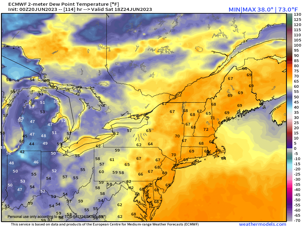
Good morning everybody, this morning will be another #ShortAndSweetCast which will precede a day off tomorrow so I can get some more rest and gear up for what looks like an active and unsettled period of weather in the fairly near term, including weekend that may feature some washed out periods, as humidity soars (we’ve been lucky to date) and helps to foster heavy rain potential.
The hits keep coming in terms of areas of upper low pressure that keep setting up over the eastern U.S. We have one departing Atlantic Canada today, but will help generate isolated showers over the region today. We have a second in the southeast U.S. that now could bob north faster and bring showers to us by Thursday or Friday, and then we have a third that looks to drop into the Great Lakes into next week.
The only real break in the action I can see is tomorrow, which is why I’m going to force myself to take a day of absence and brain rest, as an active period is upcoming.
And thank you for all of the wishes of wellness yesterday, it worked because I am feeling better this morning! :-)
SUMMARY
–Highs today will reach the 70s under mostly cloudy skies, with some sunny breaks or periods
–Some isolated to scattered showers are expected as a weaker wave moves through the region
–Lows tonight drop into the 50s, and a shower or thunderstorm is possible early
–Wednesday looks nicer with highs in the 70s again, and dry conditions expected under partly sunny skies, with lows either side of 50º
–Thursday is a wild card at the moment. There’s inertia to want to paint it as a mostly sunny day and while that could come to pass, I wouldn’t be surprised if showers made it into at least northern CT as some signals show our southeastern low pushing energy north. Hopefully high pressure suppresses activity south
–Highs 75-80º with lows in the 50s
–Humidity increases into Friday and Saturday (see attached chart), with dewpoints coming up into the 60s to low 70s this weekend, so Soupy Sales is coming back to down (yes I’m old, my apologies to the younger folk for whom this reference results in mental question marks)
–As humidity comes up, so do the shower and downpour chances, especially over the weekend
–It could rain hard at times this weekend with temps either side of 80º for highs, with thunderstorms possible as well
–These conditions could persist into early next week
That’s how things look now, folks, like I said unless something drastic changes, I won’t post tomorrow and will be back Thursday morning.
Have a great day!
