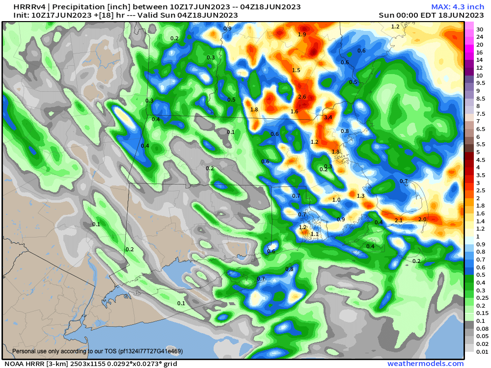
Good morning everybody, our surface low has tracked a bit further away from our area overnight, but we still do have an upper low over northern NY that is going to track southeast into the region today.
As I had mentioned yesterday, the heaviest/steadiest of the precipitation was most likely going to fall north of the MA/CT state line and that still looks to be the case, with much less rainfall and showers in CT today, and we could even see some breaks of sun down that way.
North of there in WMass, CMass, SVT and SWNH we’re already already seeing showers in spots this morning, some heavy at times, and at this point, we can generally expect heavier rain from Worcester County eastward through tonight, though WMass / SVT / SWNH will see periods of showers, some heavy today.
However, between a bit more dry air and the surface low being a little further away, precipitation won’t be as stratiform or steady as it looked like it would be yesterday.
Still, a damp day lies ahead with mostly cloudy skies, and periods of showers, and a few thunderstorms, mixed in with times when it’s not raining. Severe weather is not expected.
Highs will reach the 60s today with patchy fog possible in spots.
Showers will taper off through tonight with lows dropping into the low to mid 50s as the upper low passes through the region and heads out to sea, which may represent the final upper low in this unseasonable pattern in which we’ve found ourselves for weeks now.
Sunday / Father’s Day is looking nicer! A partly sunny day looks to be in the offing with a few showers at times passing through and highs in the low to mid 70s with lows in the 50s as the upper low loses its influence over us.
The on Monday and Tuesday, we’ll have some cooler air aloft which will promote the development of some scattered afternoon instability showers each day, but we’ll also have a mix of sun and clouds with highs in the 70s both days and lows in the 50s.
By mid to late week, high pressure should start to take better hold over the region as a Rex Block pattern begins to wane, with ridging tracking more east over New England.
This will produce warmer temps and brighter skies with highs climbing well into the 80s by late week as astronomical Summer arrives in alignment with peak light of 2023.
As the local band Winterpills sings so beautifully, freeze your light, and while that song relates to capturing life and light in photography (at least that’s what I get from it), we can all employ that idea with our minds to “freeze our light” as it peaks through the region through the end of the month… these long days with very early morning and very late evenings are such a joy worth pulling into our beings in everywhere — Enjoy / InJoy!!!
