 Good morning everybody, our weekend is looking pretty good compared to recent conditions related to our weather and our air quality due to Canadian wildfire smoke – tough week!
Our air quality continues to be much improved according to airnow.gov and other air testing/data sources and sites, and the sky actually looks blue, so there’s that.
As for our weather, we have our upper low departing, but its circulation continues to cycle areas of cloudiness through the region, which will be the case today: a mix of sun and clouds and any patchy fog will burn off as air temps come up off of the dewpoints.
There will also be some afternoon showers, but I don’t expect a lot of activity today, more isolated in nature as a drying influence continues to develop into the region.
Highs reach the upper 60s to mid 70s with lows either side of 50º under partly cloudy skies.
For Sunday, it’s pick of the month/weekend/week/whatever!
We’ll enjoy a legit summery day with partly to mostly sunny skies ande highs in the mid 70s to low 80s as southwest flow sets up, and this should start the process of cleaning the air even further, which should continue into next week, so we’re on the right side of things, smoke-wise.
Some showers are possible by Sunday evening/night with lows well into the 50s.
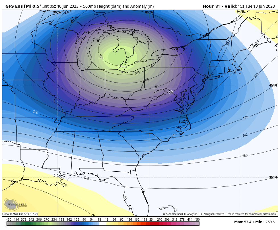
Once we get into next week, though, unsettled conditions return as another upper low drops into the Great Lakes (see attached chart) and tracks east, sweeping up moisture from severe weather convection down in Texas, gathering it, and absorbing it into a cold frontal boundary that moves through by Tuesday.
It will still be warm Monday with highs in the mid to upper 70s under mostly cloudy skies and increasing warm advection showers into Monday night, which will be mild and near 60º.
Monday night into Tuesday looks quite rainy at the moment, with a good widespread soaking expected which should also help knock any lingering particulate matter down and also sweep it out with the frontal passage, that’s my belief anyway. Highs on Tuesday will again be in the 70s.
By Wednesday through Friday, the upper low comes overhead, and should create a chance for afternoon instability showers, especially on Wednesday, with less chance late in the week.
Our days should be partly sunny during this period with highs in the 70s, so temps are coming up, smoke is going down, rain is coming up which we need, and severe weather is not expected.
Happy days, as Jamie Oliver (one of my favorite cooks) likes to say, enjoy your Saturday!
