 Good morning everybody, after periods of heavy rain for some along with isolated pockets of damage from wind, flooding, and lightning strikes, we have a much more tranquil yet unsettled period coming up through next week, so I’m going to run through the details via my now-famous, unpatented, untrademarked, and unofficial Double–Dash–Delivery System (DHTWN’s Triple D, for short):
–An upper low is diving south through Maine and the waters off of the eastern New England coastline today
–This will help produce northerly and northeasterly winds gusting up to 20-25mph today, especially east of I-91
–Highs will only range from the mid 50s to low 60s, some 30 degrees cooler than yesterday!
–Some patchy drizzle is possible this morning, but the WMass region should be drying out this afternoon
–Mostly cloudy skies hopefully transition to partly sunny by later this afternoon, which should help The Asparagus Festival in Hadley
–For tonight, chilly lows will dip into the low to mid 40s under partly to mostly cloudy skies
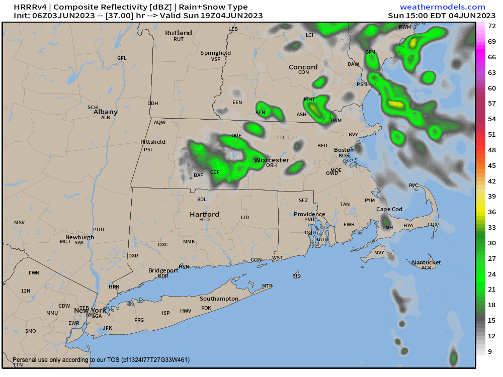
–On Sunday, we should start off with some breaks of sunshine, but a wave of energy will be rotating southwestward off of the ocean, around the coastal upper low, and toward the WMass region
–This means clouds are likely to increase sometime around mid-day
–Highs will again reach either side of 60º, and some scattered showers are expected in the afternoon to early evening, especially over Worcester County and northeast CT
–Lows again will drop to the low to mid 40s
–Monday looks fairly dry, and likely partly sunny especially the further west you go with highs near 70º
–Remember the period from today through Monday has the rainiest, chilliest, and windiest impacts in eastern MA and RI
–It is the Tuesday through Thursday period that looks to be dominated by another upper level low pressure system
–This is when unsettled weather become more widespread, but scattered in its presentation
–During that period I expect occasional showers at times, possibly mixed with graupel or hail due to a lowering freezing level from aloft
–Highs will be in the 60s, lows in the 40s, and we’ll see mixes of sun, clouds, showers and even a few thunderstorms during that time
–By Friday we may have a light warm up into the low to mid 70s which may continue into the weekend before ANOTHER upper low possibly cools us down, but we’ll deal with that when we get closer to that timeframe
Have a great day!
