Good morning folks, it appears some areas up near Rt. 2 on north started with very patchy fog. However, we’re now on the way to glorious sunshine with a few puffy clouds later followed by a milder but more partly sunny day with a few showers overnight into a warming Monday with 70s highs, a brief cool down mid-week and then another warm-up late week, but before we jump into the weather and daily details below, let’s check a note from our new weekend sponsor, #RedFireFarm located in Granby, MA.
~~~~~~~~~~~~~~~~~~~~~~
A NOTE FROM OUR WEEKEND SPONSOR:
Dave Hayes The Weather Nut is Sponsored by Individual Community Members, Patrons & Red Fire Farm. The Red Fire Farm store is open daily at 7 Carver Street in Granby, MA, and if you are looking for delicious organic produce, join their Summer CSA farm share. Vibrant greens, luscious heirloom tomatoes, sweet carrots and lots more to enjoy. Shares get free Pick Your Own, kicking off with strawberries in June. Add pastured eggs, local fruit & cheeses, mushrooms, pantry items, bouquets of organic flowers, and more. Weekly pickups at the Granby farm, Montague, Amherst, Forest Park/Springfield, Northampton, & Worcester (plus home delivery available), so click here now and snag your Summer Share!
~~~~~~~~~~~~~~~~~~~~~~~~~~~~~~~~
IT’S GONNA BE NICE, ENJOY IT!
–Any patchy fog burns off and reveals a glorious Spring day with sunshine, some fair weather clouds and highs in the mid 60s to low 70s
–Lows tonight will be mostly clear and be great for viewing the waning Flower Moon with lows in the low to mid 40s
–On Sunday, we’ll start off mostly sunny, but some partial sunshine should develop by late afternoon
–Highs again will reach the upper 60s to low 70s
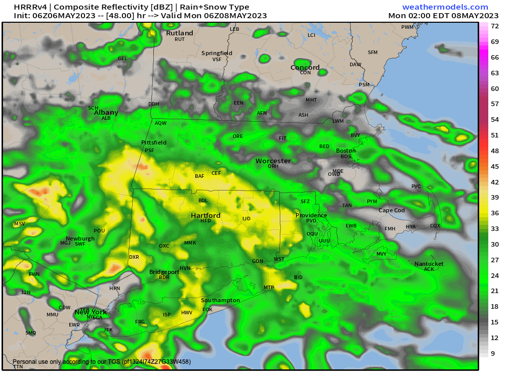
–A warm front approaches Sunday night with clouds building and a period of showers will move through the region (chart attached), especially southwest MA into northwest and north-central CT
–Lows will be milder, in the upper 40s to low 50s
–Any very early morning Monday showers or clouds clear as the morning wears on, with a warmer day on the way
–In fact highs should be well into the low to mid 70s and we can’t even rule out a few upper 70s in the Springfield-Hartford stretch
–On Tuesday and Wednesday we’ll take a bit of a dip temperature-wise
–A back door cold front should swipe through the region, representing the last circulatory gasp of our old upper low which will have retrograded enough to foist its western fringe effects up on us
–What does that mean? Not much, except that temps tamp down into the 60s for highs for a couple of days
–There’s a low risk of a shower in northwest CT Tuesday night as a storm passes to our southwest as well
–By Thursday and Friday, a ridge should be developing across the region, bringing more sunshine and temps back up into the 70s
–I don’t see any return of a cool or wintry pattern at this point, though one can never be sure until Memorial Day in southern New England
–But if I were a betting man, I’d say it’s a reasonable time to Spring-ify your operations
Have a great day!
BE KIND
“Hello babies. Welcome to Earth. It’s hot in the summer and cold in the winter. It’s round and wet and crowded. On the outside, babies, you’ve got a hundred years here. There’s only one rule that I know of, babies: Goddamn it, you’ve got to be kind.”
–Kurt Vonnegut
