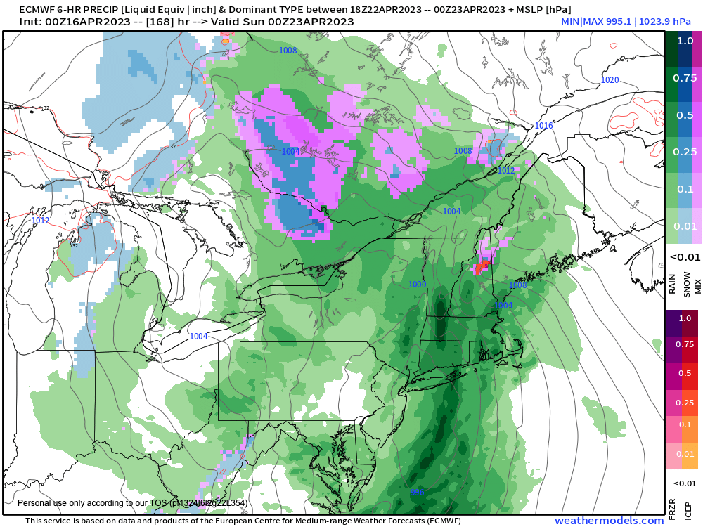
Good morning folks, some of us got a serious drink of rain yesterday (notably central areas of Hampden County), but aside from a spot light shower or some drizzle, we’ll be light on precip today and tonight before more rain moves in tomorrow morning with a cold frontal passage with a secondary wave for Tuesday. Despite a sunny mid-late week period that starts cool and then warms, we’ll be watching for more rainfall by next weekend that could be substantial, but before we jump into the weather and daily details below, let’s check a note from our new weekend sponsor, #RedFireFarm located in Granby, MA.
~~~~~~~~~~~~~~~~~~~~~~
A NOTE FROM OUR SPONSOR:
Dave Hayes The Weather Nut is Sponsored by Individual Community Members, Patrons & Red Fire Farm. The Red Fire Farm store is open daily at 7 Carver Street in Granby, MA, and if you are looking for delicious organic produce, join their Summer CSA farm share. Vibrant greens, luscious heirloom tomatoes, sweet carrots and lots more to enjoy. Shares get free Pick Your Own, kicking off with strawberries in June. Add pastured eggs, local fruit & cheeses, mushrooms, pantry items, bouquets of organic flowers, and more. Weekly pickups at the Granby farm, Montague, Amherst, Forest Park/Springfield, Northampton, & Worcester (plus home delivery available), so click here today to snag your Summer Share!
~~~~~~~~~~~~~~~~~~~~~~~~~~~~~~~~
LOOK OUT BELOW……
–We’re starting off mild this morning, but temps won’t rise all that much in a fairly humid, stagnant pattern today with mostly cloudy skies and patchy fog and drizzle at times
–What you see is mostly what you’ll get, though some sunny breaks are possible at times, and highs will be in the upper 50s to mid 60s
–For tonight, more of the same really, including patchy fog and/or drizzle and lows near 50º with mostly cloudy skies, light wind, stagnant
–For Monday, a cold front will be pushing toward the region, but we’ll be on a far edge of its potency, so while showers and a thunderstorm are expected, no squall lines are expected
–Highs will reach the mid to upper 50s, and scattered showers will continue into the afternoon and begin to wane by evening
–Lows will drop into the mid to upper 40s
–Tuesday should start off mostly cloudy with a few showers accompanying by a trailing wave behind the front, but partly sunny skies should develop with highs in the mid to upper 50s, and lows in the mid to upper 30s as a colder flow moves in
–Mid to late week looks mostly sunny with high pressure building into the region with highs in the 50s and lows in the 30s on Wednesday
–For Thursday and Friday, highs will come up into the 60s with fair weather, with lows in the 40s as milder air works into the region
–By next weekend, a more potent system looks poised to push into our region with a strong frontal boundary and more substantial rainfall
–For now this system looks to arrive Saturday and may linger through the weekend, with some unsettled conditions into next week, but I will refine that as we get closer.
Have a great day!
BE KIND
“Hello babies. Welcome to Earth. It’s hot in the summer and cold in the winter. It’s round and wet and crowded. On the outside, babies, you’ve got a hundred years here. There’s only one rule that I know of, babies: Goddamn it, you’ve got to be kind.”
–Kurt Vonnegut
