
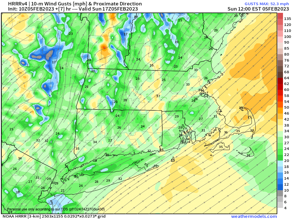
Gusty southwest winds today.
–It is 40º warmer this morning when compared to yesterday!
–Bermuda high and Great Lakes low tag-team to produce gusty southwest winds later this morning and afternoon
–A sprinkle or flurry overnight otherwise dry into Tuesday, mild
–Tuesday night sees a frontal boundary swing through with scattered showers, possibly mixed with snow
–Wednesday is the sunny pick of the week
–Clouds build back Thursday with showers by afternoon, which may last through Saturday, and more likely would come as a couple of pulses from two different systems
–Temps are in the upper 30s to upper 40s through the week, with lows in the mid 20s to low 30s range
–Next Sunday/Monday may be a bit more wintry but low chance for now
——————————————-
***DHTWN DAILY WEATHER REPORT***
——————————————-
Good morning folks, all outages have been restored and temps are up by 30 to 40 degrees this morning, and they’re going up even further from here, landing in the upper 30s to mid 40s, which is a 60-70 degree increase in about 30-36 hours!!
We’ve got a resumption of the Pacific pattern when we’ve been in like a broken record this winter, which is a bit odd for a La Nina to Neutral ENSO pattern. However, I gave up trying to understand the maddening exercise around how all of the tropospheric and stratospheric teleconnective / macro / global patterns sync together (or not) and how that affects local conditions here in the greater WMass region.
If you talk to seasonal forecasters they readily admit how difficult it is, and I’ve seen more than one big snow forecast for this season bust spectacularly to date.
It’s hard enough with the next 7 to 10 days, and that is the zone within which I firmly reside.
Anyway, enough blabby rambling! Highs will reach the upper 30s to mid 40s today under partly sunny skies on average with periods of clouds, and a gusty and milder southwest wind developing which will blow to 20-35ph at times.
Clouds will build tonight as a trough moves through the region, and while a flurry or a shower are possible, they should be relegated to southeast MA. Lows will bottom out in the upper 20s to low 30s.
For Monday, clouds should decrease as the day wears on with mostly sunny skies developing and highs again reaching the upper 30s to mid 40s as a cold front clears the region. Lows will drop into the upper teens to low 20s under mostly clear skies.
On Tuesday, a warm front will extend towards the region with increasing clouds and highs in the upper 30s to low 40s.
We’ll see some scattered rain showers move into the region by evening, and some snow may mix in over the high terrain and overnight. Lows will end up near freezing.
Wednesday looks much nicer and breezy with mostly sunny skies developing, again with highs in the upper 30s to mid 40s, and lows in the upper 20s to low 30s.
Once we reach the Thursday to Saturday period, it’s looking stormier, or at least inclement in general, with similar high temps but more clouds and periods of rain showers that look more substantial than what will be moving through for Tuesday.
How that period will play out is still a bit murky, so I will have to refine as we get closer, but you can expect showery conditions for now and we’ll tidy up the timing and spiff up the specs as the days go by.
Thank you so much for reading, and sticking with me all of these years, I really appreciate it. Also, please click the LST link below for other ways we can remain in touch, and have a great day!
Let’s Stay Together (click for options).
Join my Free Weekly Nutletter (click to join).
Follow me on Twitter (click to follow).
AND REMEMBER…
“Hello babies. Welcome to Earth. It’s hot in the summer and cold in the winter. It’s round and wet and crowded. On the outside, babies, you’ve got a hundred years here. There’s only one rule that I know of, babies: Goddamn it, you’ve got to be kind.”
–Kurt Vonnegut