
Winter weather potential is starting to show on models.
–*I’ve been reporting our weather daily here and at WesternMassWeather.com for almost a decade*
–Please visit my FB page via the app or web like selecting a TV station you want to watch (or in this case, read)
–I’m always here daily, so check in with me and say hi!
DAVE’S WEEKLY WEATHER NUTSHELL
–A fair, early December day with seasonable temps
–Southerly gusts to 20mph with clouds increasing later
–A few scattered showers on a mostly cloudy Tuesday
–Showers increase by late afternoon, and steadier rain moves in Tuesday night late into Wednesday
–Mild temps Tuesday through Thursday (cresting into the low/mid 50s)
–We dry out by Thursday afternoon into Friday as cooler air works back into the region
–Friday/Saturday may feature a storm, and then early next week as well, can’t rule out wintry precipitation
Now then, before we jump into the weather discussion/details below, let’s check a note from our local and delicious sponsor, #TandemBagelCo, with their newest location in West Springfield, MA.
——————–
A NOTE FROM OUR SPONSOR:
DHTWN Is Sponsored by Members, Patrons & Tandem Bagel Company: No matter the weather, Tandem Bagel is always there for you at several valley locations to make your mornings brighter! With bagels baked fresh daily (including Gluten-Free options), house-whipped cream cheese, coffee, and tons of lunch options, Tandem is the perfect quick stop for lunch, breakfast, or a coffee and bagel to go. Find them in Easthampton, Northampton, Hadley, Florence, and West Springfield, or use their super-streamlined online ordering tool by visiting their website.
——————————————-
***DHTWN DAILY WEATHER REPORT***
——————————————-
NWS ALERTS
–None
DHTWN REMINDER
–The odds of being a human is 1 in 400,000 billion… make it count, even in a small way (see Kurt Vonnegut quote at end of post)
DAILY CELESTIAL (STAR):
–OUR STAR ROSE AT: 7:03am this morning
–OUR STAR WILL SET AT: 4:18pm this evening
–TOTAL DAYLIGHT TIME: 9 hours and 15 minutes
NIGHTLY CELESTIAL (MOON):
–OUR MOON WILL RISE AT: 2:45pm this afternoon
–OUR MOON WILL SET AT: 5:43am tomorrow morning
–MOON RISE DIRECTION: East-Northeast
–MOON SET DIRECTION: West-Northwest
–MOON PHASE: Waxing Gibbous (93.2%)
———————-
DAILY TERRESTRIAL (ZoneCast)
ZONE 1 (Northern Region)
Southern VT, Southwest NH, N. Taconics NY
–High Temps: Low to Mid 40s
–Low Temps: Low to Mid 30s
–Wind: Southerly gusts up to 20mph this afternoon, light early
–Skies: Mostly Sunny early with increasing clouds
–Precipitation: None
ZONE 2 (Central Region)
WMass, N. CMass, N. Litchfield County, C./S. Taconics NY
–High Temps: Mid 40s
–Low Temps: Upper 20s to Low 30s
–Wind: Southerly gusts up to 20mph this afternoon, light early
–Skies: Mostly Sunny early with increasing clouds
–Precipitation: None
ZONE 3 (Southern Region)
S. CMass, S. Litchfield County, NC.CT, & NE.CT
–High Temps: Mid to Upper 40s
–Low Temps: Low to Mid 30s
–Wind: Southerly gusts up to 20mph this afternoon, light early
–Skies: Mostly Sunny early with increasing clouds
–Precipitation: None
———————-
MORNING DISCUSSION
Good morning everybody, we’ve got one last fair weather day before we dip back into the clouds and showers tomorrow and Wednesday.
For today, departing high pressure to our east will provide a final bout of sunshine earlier in the day before clouds start to filter back into the region this afternoon and overnight.
As the high tracks east, clockwise flow around it will help produce southerly gusts increasing to 20mph or so at times this afternoon, but no big whoop.
Highs will reach well into the 40s for all of us today with this refreshened southerly flow.
Clouds continue to increase tonight, and lows will drop into the low to mid 30s.
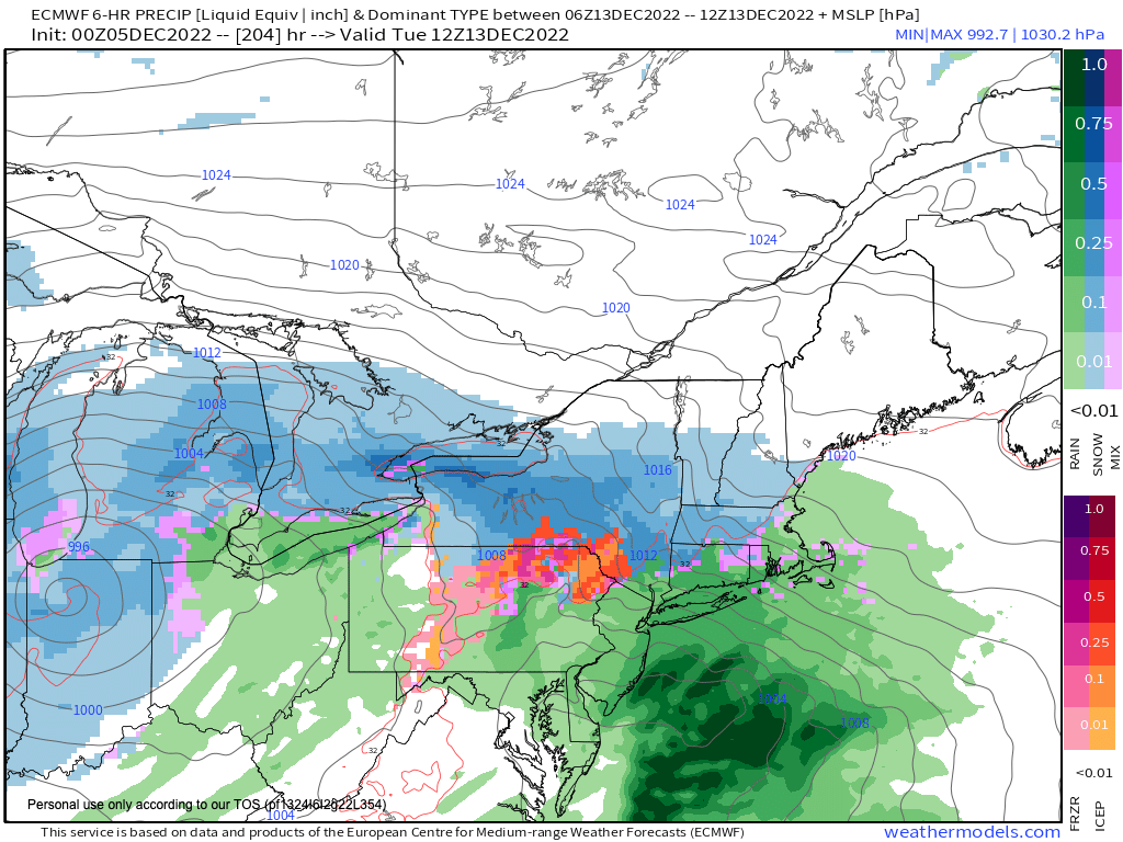
FREEZING RAIN TUESDAY MORNING?
Now, we can file this in the Unlikely Folder, but there is a very low chance that if a few showers get their act together early tomorrow morning, a few icy spots may develop… just something to file away, but I wouldn’t change morning plans or anything.
For Tuesday, any isolated showers in the morning should beget thickening clouds and an increase in showers later in the afternoon, and especially at night.
Highs will be milder, reaching the upper 40s and lows won’t come down much at all off of those highs during Tuesday night.
Another shortwave will track to our northwest and pull a deeper moisture plume into the region late Tuesday night into Wednesday, and this is when our steadiest and heaviest rain will fall (it’s possible Tuesday doesn’t see much rain at all).
Wednesday looks rainy and mild with highs in the low to mid 50s, with showers lasting into the night with lows in the 40s.
Thursday looks to develop into the pick of the week, as it will be milder with highs in the upper 40s to low 50s under partly sunny skies as our Wednesday system pulls northeast and out of here. Lows will drop into the 20s to low 30s under clearing skies.
Then we look to our Friday through Monday period, and things are murky.
We know that Friday is likely sunny and dry, and cooler with highs in the low to mid 40s and lows in the 20s.
However, there are two storms, one that could impact Friday night into Saturday, and another that could impact early next week.
Both have the potential to start off as a snow or ice, but we need to see how the Wednesday system affects the streamflow to get a better read on whether Friday night’s storm is shunted southeast of us or moves into the region, which should also help understand better what’s up for early next week.
Have a great day and if you missed the order deadline, I still have 2023 weather calendars at the link below, I won’t be doing one next year, so get ’em while you can!
Follow me on Twitter while it’s still a thing.
AND REMEMBER…
“Hello babies. Welcome to Earth. It’s hot in the summer and cold in the winter. It’s round and wet and crowded. On the outside, babies, you’ve got a hundred years here. There’s only one rule that I know of, babies: Goddamn it, you’ve got to be kind.”
–Kurt Vonnegut