
——————————-
WHERE’S DAVE?
–*I POST EVERY DAY*
–Please visit my page via app or web like choosing a TV station if you aren’t seeing my work passively show on your screens
–Day in, day out, week in, week out, month in, month out, I’m always here, whether I get “fed” to you, or not, so please visit
DAVE’S WEEKLY WEATHER NUTSHELL
–Westerly wind gusts 30-45mph today, blustery, cold
–A few snow showers possible, scattered coatings
–Calmer, sunnier on Friday
–More mild temps, rain and wind Saturday
–Blustery and cooler Sunday
–More showers Tuesday ahead of sharp cold front
–Much colder mid to late next week
Before we jump into the weather discussion/details below, let’s check a note from our local and delicious sponsor, #TandemBagelCo, with their newest location in West Springfield, MA.
——————–
A NOTE FROM OUR SPONSOR:
DHTWN Is Sponsored by Members, Patrons & Tandem Bagel Company: No matter the weather, Tandem Bagel is always there for you at several valley locations to make your mornings brighter! With bagels baked fresh daily (including Gluten-Free options), house-whipped cream cheese, coffee, and tons of lunch options, Tandem is the perfect quick stop for lunch, breakfast, or a coffee and bagel to go. Find them in Easthampton, Northampton, Hadley, Florence, and West Springfield, or use their super-streamlined online ordering tool by visiting their website.
——————————————-
***DHTWN DAILY WEATHER REPORT***
——————————————-
NWS ALERTS
–Wind Advisories continued for WMass, CMass and SVT
DHTWN REMINDER
–The odds of being a human is 1 in 400,000 billion… make it count, even in a small way (see Kurt Vonnegut quote at end of post)
DAILY CELESTIAL (STAR):
–OUR STAR ROSE AT: 6:59am this morning
–OUR STAR WILL SET AT: 4:19pm this evening
–TOTAL DAYLIGHT TIME: 9 hours and 20 minutes
NIGHTLY CELESTIAL (MOON):
–OUR MOON WILL RISE AT: 1:15pm this afternoon
–OUR MOON WILL SET AT: 1:03am tomorrow morning
–MOON RISE DIRECTION: East
–MOON SET DIRECTION: West
–MOON PHASE: Waxing Gibbouw (60.0%)
———————-
DAILY TERRESTRIAL (ZoneCast)
ZONE 1 (Northern Region)
Southern VT, Southwest NH, N. Taconics NY
–High Temps: Mid to Upper 30s
–Low Temps: Low to Mid 20s
–Wind: Westerly to northwesterly gusts 30-45mph
–Skies: Partly Sunny
–Precipitation: A few lake effect snow showers, some coatings possible
ZONE 2 (Central Region)
WMass, N. CMass, N. Litchfield County, C./S. Taconics NY
–High Temps: Mid 30s to Low 40s
–Low Temps: Low to Mid 20s
–Wind: Westerly to northwesterly gusts 30-45mph
–Skies: Partly Sunny
–Precipitation: A few lake effect snow showers, some coatings possible in the Berkshires and western hilltowns down into northern Litchfields
ZONE 3 (Southern Region)
S. CMass, S. Litchfield County, NC.CT, & NE.CT
–High Temps: Upper 30s to Low 40s
–Low Temps: Mid 20s
–Wind: Westerly to northwesterly gusts 30-45mph
–Skies: Partly Sunny
–Precipitation: A few snow showers in western parts of this region
———————-
MORNING DISCUSSION
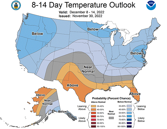
Good morning everybody, we’re starting to see signs of colder weather developing by late next week, which may set the stage for our first snowstorm.
Now, to be sure, there is nothing modeled right now, but the upper level pattern looks to be transfiguring itself into one that will supply PLENTY of cold, and if we can get storm tracks to “behave”, we could see our first substantial snowstorm sometime in the 2nd or 3rd week of December.
Something to keep an eye on for me for sure, and I will keep you updated.
Backing up to the present moment, we have cold air advection continuing this morning behind the cold front that passed through around dinner time, and Wind Advisories are continued as well through the day.
West and northwest winds will gust 30-45mph at times, possibly up to 50mph in the high terrain under partly sunny skies.
Some snow showers have coated the ground in northwest CT already, and a few more snow showers in the high terrain west of the I-91 corridor are expected into the afternoon for some.
Otherwise, we have partly sunny skies expected with highs in the mid 30s to low 40s. Winds will slacken tonight and lows will drop into the low to mid 20s.
Friday looks lovely with mostly sunny skies, high pressure building in, and highs reaching the low to mid 40s with much lighter wind. Lows will drop to the upper 20s to low 30s as clouds increase.
Essentially, a repeat of the type of frontal passages and air mass changes happens again on Saturday:
–Strong storm passes north
–This pushes a warm front through with showers in the morning and mild temps reaching the low to mid 50s
–Heavier rain moves in during the afternoon with southerly wind gusts over 40mph in some cases
–Then a cold front passage arrives shifting us to westerly wind gusts, lows in the 20s
–This leads to a colder, blustery Sunday with highs in the mid 30s to low 40s under partly sunny skies
–Monday then is the new Friday with lighter wind, sunnier skies, highs low to mid 40s
Then we may do it AGAIN with more showers by Tuesday and milder temps before the REAL cold crashes our regional party for mid to late next week.
A blocking area of high pressure is looking to set up over Greenland, so whatever cold gets delivered into the middle of the month, may get locked in here for a bit.
Mix that with a coastal storm, and we may be off to the snowy races, but that is admittedly total conjecture at this stage.
Still, when you see cold air setups like that, one must pay attention if one cares about the weather, winter weather, snow, etc., and that checks all the boxes for this writer.
Have a great day, and if you’re a fan of my work, you can support it while gearing up for the incoming cold season or get holiday gifts via my Apparel Sale with 2 new hoodie, sweatshirt, long/short-sleeve shirt designs to stay warm this winter (tee shirts and vee necks, too). Thanks.
#1: WMASS SNOW LOVERS’ TRIANGLE OF DISAPPOINTMENT
Follow me on Twitter while it’s still a thing.
AND REMEMBER…
“Hello babies. Welcome to Earth. It’s hot in the summer and cold in the winter. It’s round and wet and crowded. On the outside, babies, you’ve got a hundred years here. There’s only one rule that I know of, babies: Goddamn it, you’ve got to be kind.”
–Kurt Vonnegut