
——————————-
1.WMASS Snow Lover’s Triangle of Disappointment
2.What Does Dave Say?
——————————-
WEEKLY WEATHER NUTSHELL
We’ve turned to face our star again and we surely got an early sunrise treat, but now clouds are increasing, showers are arriving by mid to late afternoon, rain will fall over night with a thunder rumble possible, followed by a blustery Monday, a calmer and sunnier Tuesday, and more rain and wind during a milder Wednesday into a cooling Thursday, but before we dive into all of the weather details below, let’s check a note from our new local weekend sponsor, #CranberryHillHealingArts located in Amherst, MA.
——————–
A NOTE FROM OUR WEEKEND SPONSOR:
DHTWN is sponsored by members, patrons, and Cranberry Hill Healing Arts. The turning of the seasons can be challenging, and Carolyn Walker of Cranberry Hill Healing Arts in Amherst is there for you. When you are searching for ways to be at peace, seek relaxation, and feel more energetic, let Reiki & Sound Healing guide you on your journey to wholeness. Through energy work and the gentle vibrations of singing bowls, chimes, and chanting, Carolyn crafts a safe and calming space to experience renewal. Learn more and/or book your session today by visiting her website.
——————————————-
***DHTWN DAILY WEATHER REPORT***
——————————————-
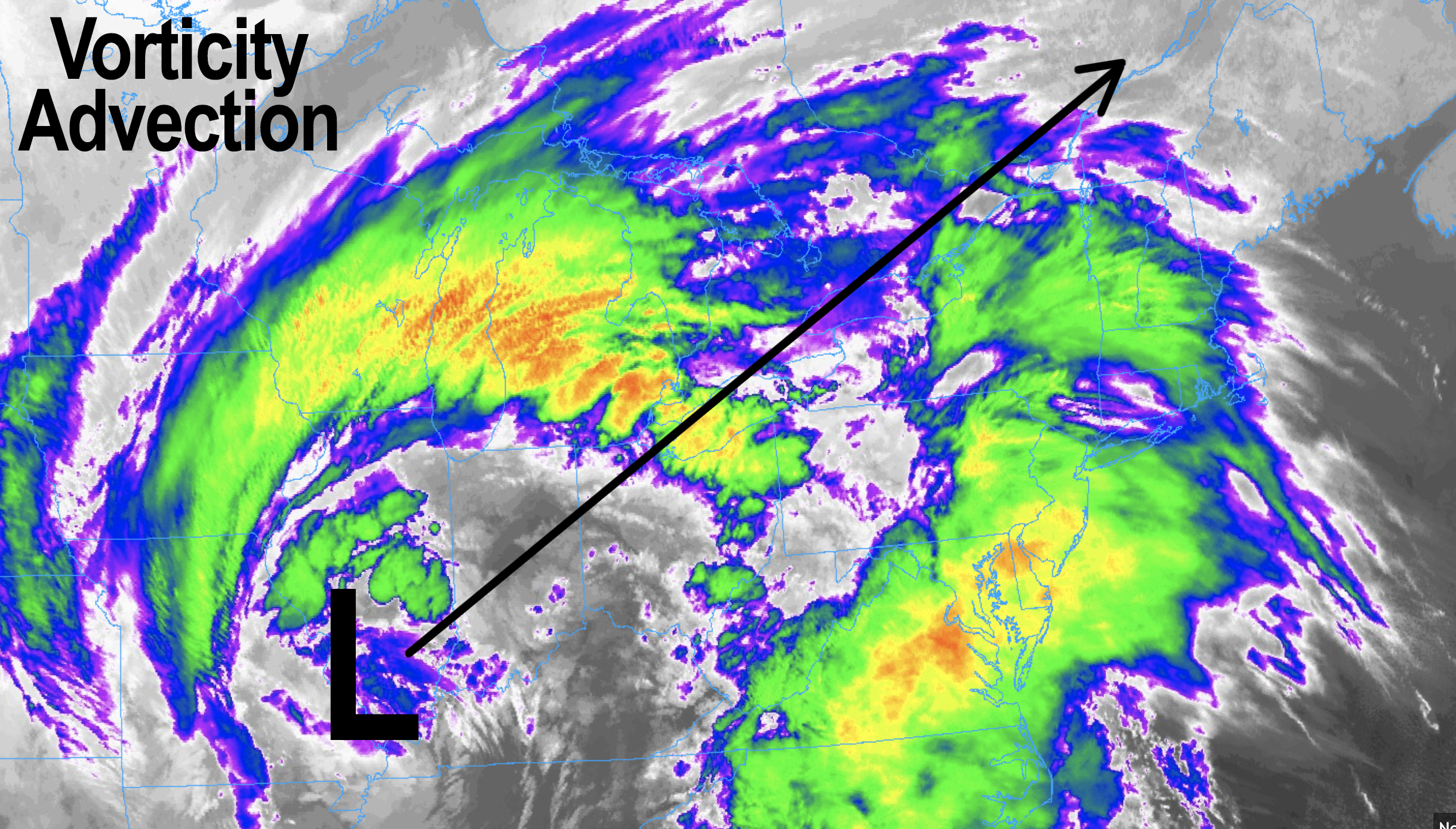
Good morning everybody, we’ve got a potent storm system tracking well northwest of us today, on up the St. Lawrence River Valley, which will spread clouds and rainfall into our region.
Southerly winds may gust a bit at high elevation, especially the hill tops east of the I-91 corridor in northeast CT and Worcester County, but otherwise fairly light until tomorrow.
Highs today reach the 45-50º with said southerly flow, and first showers should move in from southwest to northeast by mid to late afternoon, with the steadiest rain at night, into and ending during the pre-dawn hours of Monday morning.
Lows tonight will drop into the mid 30s to low 40s with wind shifting from south to west, and increasing into Monday.
We should see westerly gusts behind the cold front associated with this storm reaching speeds up to 20-30mph, and we can’t rule out an isolated shower or two Monday with mostly cloudy skies early, developing into partly sunny skies later with highs in the mid to upper 40s.
Lows Monday night will dip into the low to mid 20s as we get cold air to really drain into the region, which will set us up for a cooler but still nice late-November Tuesday with highs in the upper 30s to mid 40s under sunny skies, with lows in the upper 20s to low 30s as southerly flow redevelops ahead of a potent cold frontal system for Wednesday into Thursday.
By Wednesday, clouds will be increasing, and we’ll see a powerful low pressure system ripping toward James Bay in Canada (the southern nub of the mightier Hudson Bay) with a sweeping, giant cold front truly careening toward the eastern seaboard.
This front looks to mean business, and rain should arrive in the afternoon and bring rain and wind during the evening, and it may even flip to snow in the Berkshires, SVT and western hilltowns before ending during the pre-dawn hours of Thursday morning.
Highs Wednesday will be mild with southerly flow ahead of the front, cresting into the low to mid 50s, with southerly gusts up to 30mph before the wind shift.
By late Wednesday night into Thursday, we could be talking about wind gusting up to 45mph or so, which would necessitate the hoisting of Wind Advisories for some counties by the National Weather Service, but we’ll see how this forecasts progresses.
Wednesday night lows dip to near freezing, and Thursday blustery highs don’t climb above 40º for many folks, so wind chill will be an issue to deal with on that day.
Calmer weather arrives by Friday, with some showers possible over the weekend.
I hope you have a great day, and please do check out my Holiday Shirt Sale with 2 new designs, designed to keep you warm and cozy this cold season, just click either link below to browse colors, sizes and styles, and if you still need a 2023 weather calendar, message me, thx!
1.WMASS Snow Lover’s Triangle of Disappointment
You can also follow me on Twitter.
AND REMEMBER…
“Hello babies. Welcome to Earth. It’s hot in the summer and cold in the winter. It’s round and wet and crowded. On the outside, babies, you’ve got a hundred years here. There’s only one rule that I know of, babies: Goddamn it, you’ve got to be kind.”
–Kurt Vonnegut