MY 2023 WEATHER CALENDAR SALE ENDS IN 8 DAYS
–Learn deeply about 150 years of WMass’ most powerful storms
–Annual weather lessons and storm histories make learning fun
–Your order supports my community weather reporting work
–Calendars are affordable, useful, & quality 2022 holiday gifts
Click for Photos, Get Info, or Securely Order
——————————-
WEEKLY WEATHER NUTSHELL
Top of the morning to you and yours! The warm season with its late-Fall resurgence has left the building and now we’re talking about first snow accumulations for some of us in northwest MA, southern VT and southwest NH!
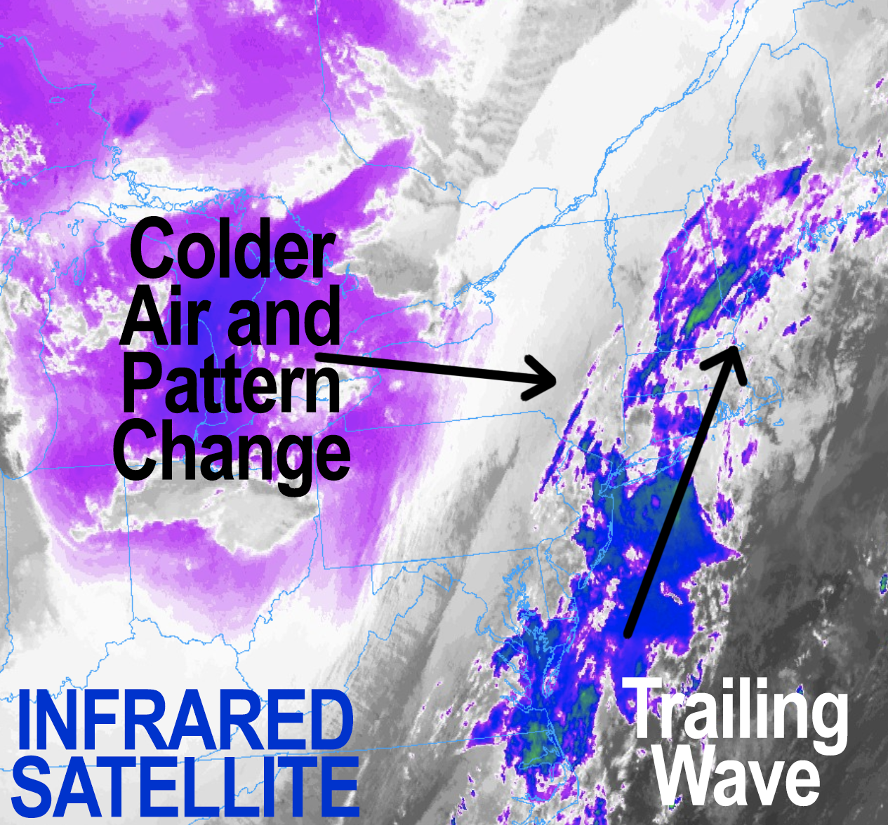
For today, we’ve got a trailing wave behind yesterday’s cold front which will bring showers through the morning at times with some clearing by afternoon, then we move into a slightly blustery Monday with colder temps into Tuesday, followed by the first snow for some Tuesday night into Wednesday morning, but before we dive into all of the weather details below, let’s check a note from our new local weekend sponsor, #CranberryHillHealingArts located in Amherst, MA.
——————–
A NOTE FROM OUR WEEKEND SPONSOR:
DHTWN is sponsored by members, patrons, and Cranberry Hill Healing Arts. The turning of the seasons can be challenging, and Carolyn Walker of Cranberry Hill Healing Arts in Amherst is there for you. When you are searching for ways to be at peace, seek relaxation, and feel more energetic, let Reiki & Sound Healing guide you on your journey to wholeness. Through energy work and the gentle vibrations of singing bowls, chimes, and chanting, Carolyn crafts a safe and calming space to experience renewal. Learn more and/or book your session today by visiting their website.
——————————————-
***DHTWN DAILY WEATHER REPORT***
——————————————-
Good morning everybody, in honor of the season’s first snowflakes that are going to fly this late Tuesday night into Wednesday morning for some in the Berkshires, western hilltowns and southern VT into the Monadnock the normal double–dashes will be turned into a pair**of**asterisks this morning, because I’m feeling festive, so here goes!
**Now that our cold front has departed the region, we have a secondary low tracking toward Nantucket today
**This is bringing showers at times to our region, more to the southeast, and less to the northwest
**Showers should quit by noon or so, with highs only reaching the 40s to near 50º, partly sunny skies develop late
**Northwest gusts this afternoon and tonight will blow 20-30mph at times as even colder advects into the region
**Lows tonight will drop into the mid to upper 20s, so bundle up if heading out!
**Monday will be breezy and colder with highs only in the upper 30s to mid 40s under mostly sunny skies, with lows in the upper teens to mid 20s
**Tuesday is more partly sunny with clouds increasing, with similar highs to Monday
**Rain and snow showers arrive around or after midnight into the Wednesday pre-dawn hours
**Air will be VERY dry preceding this system, but won’t be direct cold from the Arctic
**Also, southerly flow will develop ahead of this system, so that starts to bring milder air in to southern New England
**A battle will develop between southerly flow and evaporative cooling as precip falls into very dry air, which cools the atmosphere near the surface
**This should delay precip onset to around midnight or so, however, it could start as snow EVERYWHERE across our region, except maybe south of the Pike with rain showers there in southernmost WMass / CMass and north-central and northeast CT (northern Litchfields should snow due to elevation)
**As our storm tracks northeast out of the southern Ohio Valley toward NJ coast and eventually passing over Nantucket, we could see a coating to 3″ in the central/northern Berkshires, western Hampshire & Franklin Counties up into SVT and SWNH
**We might even see some coatings to an inch in parts of the central and northern Pioneer Valley by Wednesday morning
**We should all flip to rain during the day Wednesday, as the timing of this precip onset is really what’s allowing enough cold to be present to produce the snow, but the southern Greens may hold on to snow, where 3″+ amounts are possible
**Highs will reach the mid 30s to low 40s Wednesday with lows in the 20s as we dry out
**Thursday through Saturday looks like fair weather with highs in the 30s to low 40s and lows in the upper teens to mid 20s
**By early next week, another coastal storm may bring more wintry weather to the region before Thanksgiving!
So please stay tuned as our pattern shift is underway, have a great day, and please remember that my 2023 weather calendar sale ends next Sunday.
It’s sponsor-free this year, it’s WMass-centered, it’s likely my last ever, and it helps support my daily community weather reporting for you and yours, and you can click below to see photos & more.
SECURE CALENDAR ORDER/INFO LINK
You can also follow me on Twitter.
AND REMEMBER…
“Hello babies. Welcome to Earth. It’s hot in the summer and cold in the winter. It’s round and wet and crowded. On the outside, babies, you’ve got a hundred years here. There’s only one rule that I know of, babies: Goddamn it, you’ve got to be kind.”
–Kurt Vonnegut
