MY 2023 WEATHER CALENDAR SALE ENDS IN 9 DAYS
–Enjoy shared learning and teaching moments with kids
–Get tons of useful celestial, seasonal and holiday reminders
–Weather-themed haikus provide a thoughtful and fun twist
Click to view Photos, Get Info, or Securely Order Today
——————————-
WEEKLY WEATHER NUTSHELL
Good morning everybody, we have showers, downpours, and gusty winds in a squall line moving through the region this morning followed by warmth and sunshine today, scattered showers and cooler conditions Sunday, and much colder early next week with a potential for first snowfall for some by Wednesday morning, but before we dive into all of the weather details below, let’s check a note from our new local weekend sponsor, #CranberryHillHealingArts located in Amherst, MA.
——————–
A NOTE FROM OUR WEEKEND SPONSOR:
DHTWN is sponsored by members, patrons, and Cranberry Hill Healing Arts. The turning of the seasons can be challenging, and Carolyn Walker of Cranberry Hill Healing Arts in Amherst is there for you. When you are searching for ways to be at peace, seek relaxation, and feel more energetic, let Reiki & Sound Healing guide you on your journey to wholeness. Through energy work and the gentle vibrations of singing bowls, chimes, and chanting, Carolyn crafts a safe and calming space to experience renewal. Learn more and/or book your session today by visiting their website.
——————————————-
***DHTWN DAILY WEATHER REPORT***
——————————————-
Good morning everybody, lots to dig into this morning, so I’m going to pepper you with a blizzard of double–dashes to get the points across, have a great day!
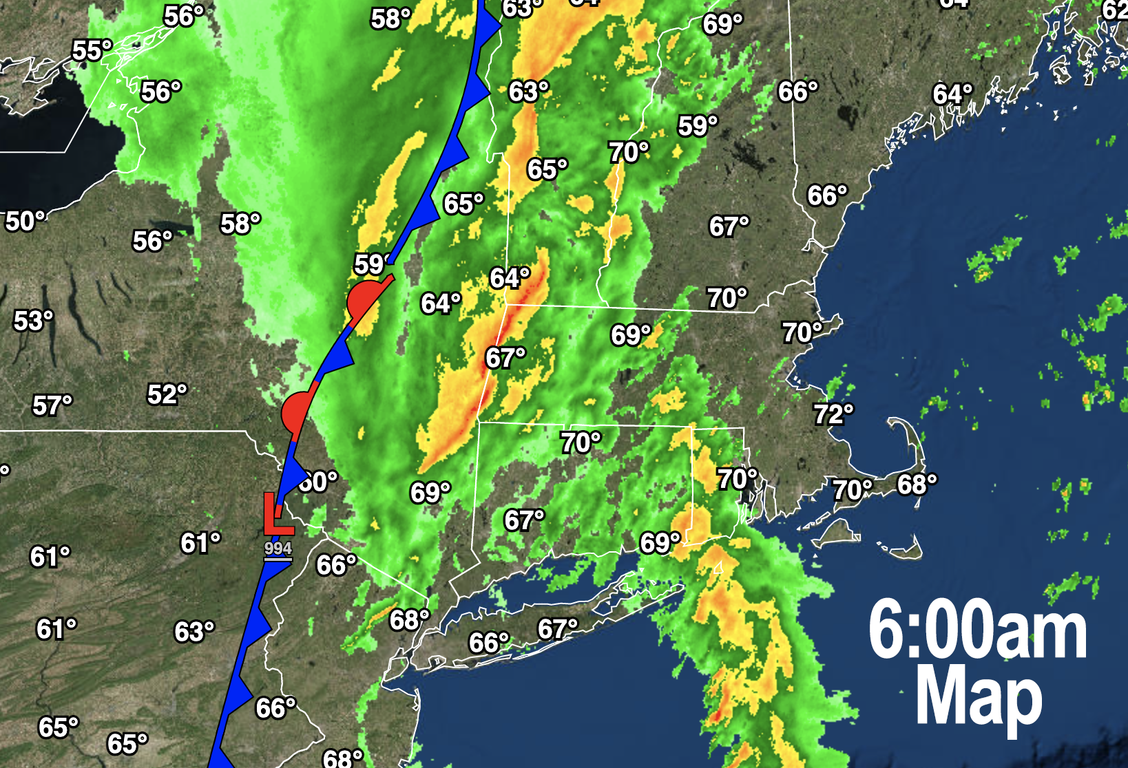
–We have a convective squall line that is quite narrow and dropping heavy rain with gusty winds as it moves into the Pioneer Valley around the 7am hour
–Winds could gust up to 40mph in spots
–It is very humid out for this time of year, and warm, and highs today will crest into the 60s and low 70s for some and then drop back into the upper 30s and 40s overnight
–Winds will shift from south to west as the frontal boundary moves through
–Sunshine will break out by late morning-ish, and we’ll get one last warm day to enjoy, as the pattern is shifting to cooler
–An upper trough swinging in behind this morning’s frontal passage will bring some scattered showers into our region Sunday morning into the early afternoon
–We can’t rule out a few periods of rain either, and it will be much cooler than today, with highs in the mid 40s to low 50s, and lows 25-30º range as we clear out and cool way down with a new air mass in town
–Monday and Tuesday look like late-Autumn days with sunshine, breezy conditions with gusts to 25mph, and cold, only in the low to mid 40s with lows in the mid to upper 20s
–Clouds increase Tuesday night as a storm system ejects out of the Tennessee Valley and heads northeast toward the NJ coastline
–This storm looks to bring rain and snow to our region by early Wednesday morning, and we can’t rule out some light accumulations in the northern Berkshires, western Hampshire/Franklin hilltowns and southern VT
–It will then get even colder behind that system with highs in the upper 30s to low 40s to end the week with partly sunny skies
If you love warmth and hate winter, get outside today and soak it up. It’s leaving, this time, likely until next warm season.
Have a great day, and I will update further if needed, and please remember that my 2023 weather calendar sale ends next Sunday. It’s my best work to date, and helps support me continuing in this community role for you and yours, thank you.
SECURE CALENDAR ORDER/INFO LINK
You can also follow me on Twitter.
AND REMEMBER…
“Hello babies. Welcome to Earth. It’s hot in the summer and cold in the winter. It’s round and wet and crowded. On the outside, babies, you’ve got a hundred years here. There’s only one rule that I know of, babies: Goddamn it, you’ve got to be kind.”
–Kurt Vonnegut
