
DAVE’S WEEKLY NUTSHELL
May The Force be with you, my friends, and may some calm and sunny weather also be with you! We’ve got a trio of loverly days ahead, though chilly and downright COLD tonight with a hard freeze, followed by a lovely weekend, Monday showers, and warmer temps into the middle of next week, but before we jump into the details, let’s check a note from our local and delicious sponsor, #TandemBagelCo, with their newest location in West Springfield, MA.
——————–
A NOTE FROM OUR SPONSOR:
DHTWN Is Sponsored by Members, Patrons & Tandem Bagel Company: No matter the weather, Tandem Bagel is always there for you at several valley locations to make your mornings brighter! With bagels baked fresh daily (including Gluten-Free options), house-whipped cream cheese, coffee, and tons of lunch options, Tandem is the perfect quick stop for lunch, breakfast, or a coffee and bagel to go. Find them in Easthampton, Northampton, Hadley, Florence, and West Springfield, or use their super-streamlined online ordering tool by visiting their website.
——————————————-
***DHTWN DAILY WEATHER REPORT***
——————————————-
NWS ALERTS
–Frost Advisories for northern CT expire early this morning
DHTWN REMINDER
–The odds of being a human is 1 in 400,000 billion… make it count, even in a small way (see Kurt Vonnegut quote at end of post)
DAILY CELESTIAL (STAR):
–OUR STAR RISES AT: 7:18am this morning
–OUR STAR WILL SET AT: 5:49pm this evening
–TOTAL DAYLIGHT TIME: 10 hours and 31 minutes
DAILY CELESTIAL (MOON):
–OUR MOON WILL SET AT: 7:57pm this evening
–OUR MOON WILL RISE AT: 12:19pm tomorrow afternoon
–MOON SET DIRECTION: Southwest
–MOON RISE DIRECTION: Southeast
–MOON PHASE: Waxing Crescent (11.3%)
———————-
DAILY TERRESTRIAL (ZoneCast)
ZONE 1 (Northern Region)
Southern VT, Southwest NH, N. Taconics NY
–High Temps: Low to Mid 50s, some Upper 50s in lower valleys
–Low Temps: Mid to Upper 20s
–Wind: Light to Calm
–Skies: Mostly Sunny, some higher clouds at times
–Precipitation: None
ZONE 2 (Central Region)
WMass, N. CMass, N. Litchfield County, C./S. Taconics NY
–High Temps: Mid to Upper 50s, some Low 50s in highest terrain
–Low Temps: Mid to Upper 20s, possibly some low 20s northern valley floor
–Wind: Light to Calm
–Skies: Mostly Sunny, some higher clouds at times
–Precipitation: None
ZONE 3 (Southern Region)
S. CMass, S. Litchfield County, NC.CT, & NE.CT
–High Temps: Mid 50s
–Low Temps: Upper 20s to Mid 30s
–Wind: Light to Calm
–Skies: Mostly Sunny, some higher clouds at times
–Precipitation: None
———————-
WEATHER REPORT
Good morning everybody, we’ve got huge high pressure parked right over New England this morning which will produce a light to calm wind today, mostly sunny skies with some higher clouds at times, and highs mostly in the 50s.
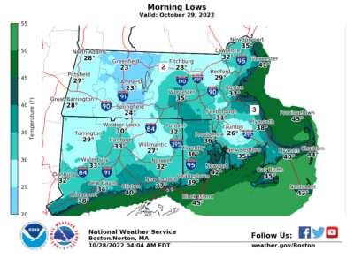
For tonight, assuming those clouds continue through and away from the region, perfect radiational cooling conditions will set up and with dry air, clear skies, and calm wind in place, lows should crash into the 20s, with some low 20s possible in the northern CT River Valley and other areas in the northern half of MA, with most of us in the mid to upper 20s and some low 30s down into northern CT.
In other words, a hard freeze is expected, but that won’t preclude a nice rebound tomorrow with highs in the upper 50s to low 60s under mostly sunny skies.
Another frosty/freeze-y night is expected Saturday night too, with lows in the upper 20s to low 30s under mostly clear skies.
Sunday will feature high pressure’s influence beginning to wane, though that means a more southerly flow with highs in the low to mid 60s under mostly sunny skies, with some clouds late in the day.
We cloud up at night with lows in the low to mid 40s, and then we’ll get some showers to move into the region likely sometime in the afternoon, though it’s not totally clear yet in terms of timing. Highs should be in the low to mid 60s.
Certainly by trick-or-treating time a few showers should be around, but there’s a bit of a weakening trend with this system and frontal boundary, so showers may be light into Monday night, so stay tuned for updates.
Any early morning Tuesday showers will give way to sunnier conditions later Tuesday through mid-week with highs generally in the low to mid 60s and lows in the low 40s as we’ll continue to get another surge of above-average temps as we push into early November. We’ll see how long that can last!
Have a great day!
LARRY PICARD SHARES HIS LOVE OF DAVE’S 2023 WEATHER CALENDAR
“Thoughtful, beautiful, and the essence of what makes western Mass what it is. Dave’s calendar is the perfect wall calendar and supports one of the things we love best about western Massachusetts: Dave Hayes and his accurate, colorful, and entertaining weather reports.”
2023 CALENDAR SECURE ORDER/INFO LINK:
Did you know that you can also follow me on Twitter?
AND REMEMBER…
“Hello babies. Welcome to Earth. It’s hot in the summer and cold in the winter. It’s round and wet and crowded. On the outside, babies, you’ve got a hundred years here. There’s only one rule that I know of, babies: Goddamn it, you’ve got to be kind.”
–Kurt Vonnegut