
Good morning everybody, we’ve got lots of dense fog out there with many quarter to half mile visibilities reported so take it easy out on the roads. After the fog lifts, we have a beautiful weekend ahead with increasing sunshine and highs in the 60s with more rain expected Monday and Monday night with much cooler temps into the middle of next week, but before we dive into all of the weather details below, let’s check a note from our local weekend sponsor, #YankeeMattressFactory, with their main headquarters in Agawam, MA along with stores located around the valley.
——————–
A NOTE FROM OUR WEEKEND SPONSOR:
DHTWN is sponsored by members, patrons, and Yankee Mattress Factory. Yankee Mattress is employee-owned, and mattresses are handmade locally in Agawam, MA. Several years ago I purchased a Yankee mattress and was very pleased with their quality and the buying experience, which was friendly and low pressure. Starting on September 1st and running through October 31st, Yankee Mattress will be partnering with the American Cancer Society to raise money to support breast cancer research and local services. A portion of each mattress sale will go towards their goal of donating $10,000 towards this cause. Visit the Yankee Mattress store closest to you in Agawam, Springfield, Northampton, or Greenfield, or click for more info.
——————————————-
***DHTWN DAILY WEATHER REPORT***
——————————————-
Top of the morning to you! Aside from dense fog this morning (dismal for some, calming for others), and maybe one or two instances of brief freezing fog with some areas like Clarksburg, MA at 32º, it will lift later this morning and sunshine will be developing with highs in the 60s.
For tonight, we’ll enjoy a mostly clear evening with lows in the upper 30s to low 40s.
On Sunday, we’ll get some more sunshine in our region with a light westerly flow and highs in the upper 50s to mid 60s, but a few clouds may increase by end of day, and certainly after sunset with lows in the low 40s.
A broad, cutoff upper level low that has been spinning around the Great Lakes for days will eject another disturbance towards our region.
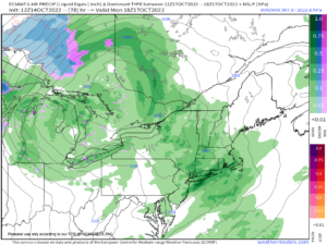
With a surface low pressure center passing north of us, we’ll see a warm and cold front press into the region late Sunday night into Monday with periods of rain showers to start the new work week.
It’ll be cooler with the rain and clouds on Monday, with highs only reaching the mid to upper 50s, with showers ending sometime Monday night and lows dropping into the upper 30s to low 40s.
The cold front will be to our east by Tuesday, and while we’ll enjoy a gorgeous day it will be quite chilly with highs only in the upper 40s to mid 50s, with lows crashing into the low to mid 30s with frost possible by early Wednesday morning.
Fair weather will continue for the rest of next week with chilly highs in the 40s and 50s and lows near freezing, with milder temps by next weekend.
Thanks for reading, and if you need holiday gifts or a calendar, this year’s offering is packed with powerful local storm histories, weather education, beautiful high-quality regional photos from local photographers, and so much more, so please visit my website for more details or to order at the following link.
Thank you, and have a great day!
Remember that you can also follow me on Twitter.
AND REMEMBER…
“Hello babies. Welcome to Earth. It’s hot in the summer and cold in the winter. It’s round and wet and crowded. On the outside, babies, you’ve got a hundred years here. There’s only one rule that I know of, babies: Goddamn it, you’ve got to be kind.”
–Kurt Vonnegut