
__________________________________
2023 WEATHER WALL CALENDAR AVAILABLE TO ORDER:
–Serene and gorgeous local photos
–Deep-drive into the Top 12 most remarkable/impactful regional storm histories, personalstories, and the under-the-hood meteorology that created them
–My weather-themed haiku
–Featured article on how the Sun drives Earth’s weather, and much more!
SECURE 2023 WEATHER CALENDAR ORDER/INFO LINK
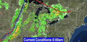
Good morning folks, once again we have some patchy fog (dense, in a few areas) but not as pervasive or dense overall as yesterday, so it should burn off faster today with temps more quickly rising out of the 30s and 40s and into the 60s and 70s.
We have a lovely, pick-of-the-week day today, clouds tonight, showers by noon tomorrow that will become heavy with wind Thursday night which will end Friday, followed by a lovely weekend ahead with more showers and cooler weather by middle of next week, but before we jump into the details, let’s check a note from our local and delicious sponsor, #TandemBagelCo, with their newest location in West Springfield, MA.
——————–
A NOTE FROM OUR SPONSOR:
DHTWN Is Sponsored by Members, Patrons & Tandem Bagel Company: No matter the weather, Tandem Bagel is always there for you at several valley locations to make your mornings brighter! With bagels baked fresh daily, house-whipped cream cheese, coffee, and tons of lunch options, Tandem is the perfect quick stop for lunch, breakfast, or a coffee and bagel to go. Find them in Easthampton, Northampton, Hadley, Florence, and West Springfield, or use their super-streamlined online ordering tool By visiting their website.
——————————————-
***DHTWN DAILY WEATHER REPORT***
——————————————-
NWS ALERTS
–None
DHTWN REMINDER
–The odds of being a human is 1 in 400,000 billion… make it count, even in a small way (see Kurt Vonnegut quote at end of post)
DAILY CELESTIAL (STAR):
–OUR STAR ROSE AT: 6:59am this morning
–OUR STAR WILL SET AT: 6:13pm this evening
–TOTAL DAYLIGHT TIME: 11 hours and 14 minutes
DAILY CELESTIAL (MOON):
–OUR MOON WILL RISE AT: 7:43pm this evening
–OUR MOON WILL SET AT: 11:02am tomorrow morning
–MOON RISE DIRECTION: East-Northeast
–MOON SET DIRECTION: West-Northwest
–MOON PHASE: Waning Gibbous (92.7%)
———————-
DAILY TERRESTRIAL (ZoneCast)
ZONE 1 (Northern Region)
Southern VT, Southwest NH, N. Taconics NY
–High Temps: Upper 60s to Low 70s
–Low Temps: Mid to Upper 40s
–Humidity: Comfortable
–Wind: Light southerly to calm
–Skies: Patchy fog early, then Mostly Sunny
–Precipitation: None
ZONE 2 (Central Region)
WMass, N. CMass, N. Litchfield County, C./S. Taconics NY
–High Temps: Upper 60s to Low 70s
–Low Temps: Upper 40s to Low 50s
–Humidity: Comfortable
–Wind: Light southerly to calm
–Skies: Patchy fog early, then Mostly Sunny
–Precipitation: None
ZONE 3 (Southern Region)
S. CMass, S. Litchfield County, NC.CT, & NE.CT
–High Temps: Upper 60s to Low 70s
–Low Temps: Low to Mid 50s
–Humidity: Comfortable
–Wind: Light southerly to calm
–Skies: Patchy fog early, then Mostly Sunny
–Precipitation: None
———————-
WEATHER REPORT
Good morning, denizens of the Golden West! The emerging colored pigments in our leafy deciduous trees have been taking to me lately, and amongst their other pearls of wisdom, they told me you require more double–dashes for detailed detail delivery. Because in Life one must flow with the current at times, I will spill out all of our salient weather details below!
–Departing high pressure off of the Mid-Atlantic coast brings a light southerly flow, and warmer temps today with highs in the upper 60s to low 70s
–I can’t encourage you enough to get outside and soak up this wonderfulness under sunny skies (after patchy fog burns off)
–Clouds will increase tonight and lows will dip to the upper 40s to mid 50s
–By tomorrow a powerful low center will be near the Great Lakes extending a huge plume of moisture driving from south to north up the eastern seaboard and into New England
–We could see a few showers in the morning, but the bulk of the rain comes in the afternoon and overnight hours, with heavy rain at times overnight
–In addition, southeast winds may gust 25-40mph, and a few embedded thunderstorms could move through and mix some more wind to the ground and also cause isolated pockets of street flooding or power outages
–Highs Thursday will reach the mid to upper 60s and lows will be in the low to mid 50s
–Rainfall totals should land somewhere in range of half inch to to 2″, with east-facing hilltowns possibly seeing higher amounts due to southeast winds enhancing orographic effects
–There may be a dry slot type area that works in and keeps some totals lower, but I will update on that
–Rain may continue into Friday morning, especially along and east of I-91 corridor
–Sunshine breaks out Friday afternoon with highs in the low/mid 60s and lows in the low/mid 40s
–Beautiful weekend ahead with sunshine and highs in the low to mid 60s and lows in the 40s
–Early next week looks cooler and under the influence of an upper level system and closed low near the Great Lakes with periods of clouds, and some scattered showers
–There is a potential of a lake-effect set up by mid week and I wouldn’t be surprised if some folks in far northwest MA, the Taconics or SVT saw first snowflakes at night, but I will keep you updated on that potential
Have a great day, and please check out my 2023 calendar, it’s a great local-color-filled daily companion, you’ll learn a bunch of cool local weather history, and it’s great for holiday gifts too!
SECURE 2023 WEATHER CALENDAR ORDER/INFO LINK
Did you know that you can also follow me on Twitter?
AND REMEMBER…
“Hello babies. Welcome to Earth. It’s hot in the summer and cold in the winter. It’s round and wet and crowded. On the outside, babies, you’ve got a hundred years here. There’s only one rule that I know of, babies: Goddamn it, you’ve got to be kind.”
–Kurt Vonnegut