
__________________________________
2023 WEATHER WALL CALENDAR AVAILABLE TO ORDER:
–Serene and gorgeous local photos
–Deep-drive regional storm histories, stories, and the meteorology involved
–Weather-themed haiku
–Featured article on how the Sun drives Earth’s weather, and much more!
Good morning folks, we have a few showers moving through this morning and some patchy fog, but the showers will abate, the fog will lift, the clouds will mostly clear, the warmth will commence, the winds will shift, the colder air will arrive tonight on gusty northwesterlies, a perfect autumnal weekend awaits, frost is possible Sunday night, and more fair weather greets us next week with showers by late week, but before we jump into the details, let’s check a note from our local and delicious sponsor, #TandemBagelCo, with their newest location in West Springfield, MA.
——————–
A NOTE FROM OUR SPONSOR:
DHTWN Is Sponsored by Members, Patrons & Tandem Bagel Company: No matter the weather, Tandem Bagel is always there for you at several valley locations to make your mornings brighter! With bagels baked fresh daily, house-whipped cream cheese, coffee, and tons of lunch options, Tandem is the perfect quick stop for lunch, breakfast, or a coffee and bagel to go. Find them in Easthampton, Northampton, Hadley, Florence, and West Springfield, or use their super-streamlined online ordering tool by visiting their website: https://www.tandembagelco.com
——————————————-
***DHTWN DAILY WEATHER REPORT***
——————————————-
NWS ALERTS
–None
DHTWN REMINDER
–The odds of being a human is 1 in 400 trillion… make it count, even in a small way (see Kurt Vonnegut quote at end of post)
DAILY CELESTIAL (STAR):
–OUR STAR ROSE AT: 6:53am this morning
–OUR STAR WILL SET AT: 6:21pm this evening
–TOTAL DAYLIGHT TIME: 11 hours and 28 minutes
DAILY CELESTIAL (MOON):
–OUR MOON WILL RISE AT: 5:42pm this afternoon
–OUR MOON WILL SET AT: 5:15am tomorrow morning
–MOON RISE DIRECTION: East
–MOON SET DIRECTION: West
–MOON PHASE: Waxing Gibbous (92.5%)
———————-
DAILY TERRESTRIAL (ZoneCast)
ZONE 1 (Northern Region)
Southern VT, Southwest NH, N. Taconics NY
–High Temps: Upper 60s to Mid 70s
–Low Temps: Mid to Upper 30s
–Humidity: Comfortable
–Wind: Westerly gusts to 10mph increase by evening to 20-25mph out of the northwest
–Skies: Partly to Mostly Sunny
–Precipitation: A few showers possible this morning, then dry… a spot shower with the cold front this late afternoon, but mostly dry
ZONE 2 (Central Region)
WMass, N. CMass, N. Litchfield County, C./S. Taconics NY
–High Temps: Low to Mid 70s (can’t rule out upper 70s)
–Low Temps: Upper 30s to Low 40s
–Humidity: Comfortable
–Wind: Westerly gusts to 10mph increase by evening to 20-25mph out of the northwest
–Skies: Partly to Mostly Sunny
–Precipitation: A few showers possible this morning, then dry… a spot shower with the cold front this late afternoon, but mostly dry
ZONE 3 (Southern Region)
S. CMass, S. Litchfield County, NC.CT, & NE.CT
–High Temps: Low to Mid 70s (can’t rule out upper 70s)
–Low Temps: Low to Mid 40s
–Humidity: Comfortable
–Wind: Westerly gusts to 10mph increase by evening to 20-25mph out of the northwest
–Skies: Partly to Mostly Sunny
–Precipitation: A few showers possible this morning, then dry… a spot shower with the cold front this late afternoon, but mostly dry
———————-
WEATHER REPORT
Good morning everybody, we’ve got some highly un-impactful weather over the next 7 days, so be sure to insert into your brain the main refrain of the Mary Tyler Moore show’s theme song as your earworm for the day.
I know you’ve got places to be, people to see, appointments to keep, and matters to attend to, so without further adieu, I give you, this week’s Double–Dash Proliferation Event (DDPE):
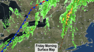
–We’ve got a pre-frontal wave moving through with a few showers this morning, representing the leading edge of warmer temperatures
–While a temperature inversion aloft (where temps are warmer than the surface, as usually it’s warmer below and colder aloft) may prevent such a hoped-for reality, it’s not impossible that we hit the upper 70s in some spots today!
–Otherwise we can expect low to mid 70s for highs with lifting fog, dissipating clouds, exiting showers, and increasing sunshine
–Some areas in SVT may sit in the upper 60s, and some areas will see more partly sunny vs. mostly sunny skies, but a very nice and warm early October day arrives to end the work week
–Our cold front will move through sometime around mid to late afternoon, possibly with a few more scattered showers, and definitely with a wind shift from lighter westerly, to gusting 20-25mph out of the northwest by early evening
–Lows tonight will crash into the mid 30s to mid 40s from north to south, but our breezy conditions should preclude frost formation from gaining hold
–For Saturday, a perfect Fall day awaits with highs in the low to mid 50s under plenty of sunshine diminishing wind by afternoon. Can’t ask for much more
–At night, we should be calm, cool, and clear which should maximize radiational cooling and drop us into the low to mid 30s with a potential for scattered to a wider-spread frost
–I’ll pass along any Frost Advisories that get hoisted by the NWS, if they’re activated
–Sunday is a touch milder, with sunshine and highs in the upper 50s to low 60s. You can’t ask for a nice Autumn weekend, folks!!!
–Lows will drop to the upper 30s Sunday night
–Sunshine rules for Monday through Wednesday at least, with highs in the upper 50s to mid 60s Monday and Tuesday, and well into the 60s on Wednesday as southwesterly flow develops ahead of our next frontal passage
–By next Thursday and Friday, a strong low pressure system could be tracking east through southeastern Canada, which would push a strong cold front our way with potential for a system to develop along it and enhance rainfall here, so stay tuned for updates.
Have a great day, and please check out my 2023 calendar, it’s a great local-color-filled daily companion, you’ll learn a bunch of cool local weather history, and it’s great for holiday gifts too!
Did you know that you can also follow me on Twitter?
AND REMEMBER…
“Hello babies. Welcome to Earth. It’s hot in the summer and cold in the winter. It’s round and wet and crowded. On the outside, babies, you’ve got a hundred years here. There’s only one rule that I know of, babies: Goddamn it, you’ve got to be kind.”
–Kurt Vonnegut