
Good morning folks, we’re starting out by breathing today, which I think is a prudent course of action to start the day! We’re also starting out with temps in the 40s and 50s with similar dew points, so it’s a crisp, cool mid-August morning to be sure!
We’ll see a lovely weekend wax through the greater WMass region, with an unsettled period of isolated to scattered showers on occasion in the Tuesday through Thursday timeframe followed by increasing humidity and warmth by late week, but before we dive into all of the weather details below, let’s check a note about the Tax-Free Weekend that’s upon us from our local weekend sponsor Yankee Mattress Factory located in Agawam, MA.
——————–
A NOTE ABOUT OUR WEEKEND SPONSOR
DHTWN is sponsored by members, patrons, and Yankee Mattress Factory. Yankee Mattress is employee-owned, and mattresses are handmade locally in Agawam, MA. Several years ago I purchased a Yankee mattress and bed and was very pleased with their quality and the buying experience, which was friendly and low pressure. Tax Free weekend (Aug 13-14) is here! Go into any Yankee Mattress store to take advantage of the savings. Visit the Yankee Mattress store closest to you in Agawam, Springfield, Northampton, or Greenfield, or click for more info.
——————————————-
***DHTWN DAILY WEATHER REPORT***
——————————————-
Good morning everybody, I hope last night’s super sweet slumber weather supported your sleepy somnolescence!
It’s a gorgeous start to a gorgeous weekend with mostly sunny skies out there, and a few clouds in eastern CT and eastern CMass.
We can expect mostly sunny skies with highs in the low to upper 70s mostly, though a few spots may crest the 80º mark.
Winds will be light out of the north, and lows tonight will drop into the upper 40s to low 50s for another refreshing, early-Fall feel overnight period under clear skies.
For Sunday, another winner, with sunshine and slightly-warmer highs in the mid 70s to low 80s with a light northwest wind.
Lows will drop into the mid to upper 50s as clouds start to develop.
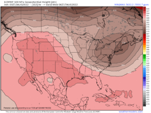
Next week looks to be on the cooler side as an upper level trough now looks to develop and deepen right over New England.
This upper low placement, should it come to pass, would be unfortunate as it would shunt the strongest and steadiest rainfall out to sea over the fish and Nova Scotia which won’t help with our drought situation which is worsening.
This means that the Monday afternoon through Thursday period should feature, on average, partly sunny skies with mostly cloudy periods and scattered showers on occasion, but not widespread or steady rainfall.
I hope this changes, but that’s how it looks now.
High temps should remain in the 70s through this period with lows in the 50s.
By Friday, this feature will roll out of here, and southwest flow will develop as the Bermuda high flexes a bit, but not anywhere near what we just experienced.
Highs should reach into the low to mid 80s by Friday, and possibly the mid to upper 80s over next weekend with more humid conditions featuring dewpoints in the 60s with scattered afternoon showers or t-storms as a summery convective pattern resumes, at least for a little while.
Have a great day! And please follow me on Twitter if you’re on it.
AND REMEMBER…
“Hello babies. Welcome to Earth. It’s hot in the summer and cold in the winter. It’s round and wet and crowded. On the outside, babies, you’ve got a hundred years here. There’s only one rule that I know of, babies: Goddamn it, you’ve got to be kind.”
–Kurt Vonnegut