
Good morning folks, we’re starting out with a few areas of patchy fog and mostly cloudy skies. Our temps are still pretty warm for the early morning, but dew points have come down, especially in northwest areas like the northern Berkshires, western Franklin County and SVT.
We’ve got slowly decreasing cloudiness today with a few isolated sprinkles or showers that could move at any time between this evening into tomorrow evening (which also means most stay dry), to be followed by much lower humidity and abundant sunshine from Friday through the weekend with the potential for an increase in showers by next Tuesday and Wednesday, but before we dive into all of the weather details below, let’s check a note from our local and delicious sponsor, #TandemBagelCo, with their newest location in West Springfield, MA.
——————–
A NOTE FROM OUR SPONSOR:
DHTWN Is Sponsored by Members, Patrons & Tandem Bagel Company: No matter the weather, Tandem Bagel is always there for you at several valley locations to make your mornings brighter! With bagels baked fresh daily, house-whipped cream cheese, coffee, and tons of lunch options, Tandem is the perfect quick stop for lunch, breakfast, or a coffee and bagel to go. Find them in Easthampton, Northampton, Hadley, Florence (and now West Springfield!), or use their super-streamlined online ordering tool by visiting their website: https://www.tandembagelco.com
——————————————-
***DHTWN DAILY WEATHER REPORT***
——————————————-
NWS ALERTS
–None
DHTWN REMINDER
–The odds of being a human is 1 in 400 trillion… make it count, even in a small way (see Kurt Vonnegut quote at end of post)
DAILY CELESTIAL (STAR):
–OUR STAR ROSE AT: 5:52am this morning
–OUR STAR WILL SET AT: 7:57pm this evening
–TOTAL DAYLIGHT TIME: 14 hours and 5 minutes
DAILY CELESTIAL (MOON):
–OUR MOON WILL RISE AT: 7:35pm this evening
–OUR MOON WILL SET AT: 4:51am tomorrow morning
–MOON RISE DIRECTION: East-Southeast
–MOON SET DIRECTION: West-Southwest
–MOON PHASE: Waxing Gibbous 95.8%
———————-
DAILY TERRESTRIAL (ZoneCast)
ZONE 1 (Northern Region)
Southern VT, Southwest NH, N. Taconics NY
–High Temps: Mid 70s to Low 80s
–Low Temps: Upper 50s to Low 60s
–Humidity: Dewpoints in the 50s to low 60s
–Wind: Calm to Light West Wind
–Skies: Mostly cloudy to partly sunny
–Precipitation: Isolated shower or sprinkle possible by afternoon/evening
ZONE 2 (Central Region)
WMass, N. CMass, N. Litchfield County, C./S. Taconics NY
–High Temps: Upper 70s to Mid 80s
–Low Temps: Low to Mid 60s
–Humidity: Dewpoints in the mid 50s to Mid 60s
–Wind: Calm to Light West Wind
–Skies: Mostly cloudy to partly sunny
–Precipitation: Isolated shower or sprinkle possible by afternoon/evening
ZONE 3 (Southern Region)
S. CMass, S. Litchfield County, NC.CT, & NE.CT
–High Temps: Low to Mid 80s
–Low Temps: Low to Mid 60s
–Humidity: Dewpoints in the 50s to Mid 60s with a possible surge into the upper 60s overnight with increased humidity as low pressure moves along the south coast
–Wind: Calm to Light West Wind
–Skies: Mostly cloudy to partly sunny
–Precipitation: Isolated showers late afternoon and overnight
———————-
WEATHER REPORT
Good morning everybody, I’m happy to report that the heat wave and oppressive humidity has left the building for the foreseeable future.
To be sure, the remnant heat from the past week is still being felt this morning with temps for many of us well into the 60s, with some low 70s, but dewpoint temps have come down into the 50s in our northwestern zones, and low to mid 60s for most of the rest of us. #Progress
For today, our first of two cold fronts will rest to the south of us near the southern New England coastline as a wave or two of low pressure ripple east along it.
For us in the greater WMass region, this will translate to a dry day with highs in the mid 70s to mid 80s from north to south, with most of us in the upper 70s to low 80s.
We’ll see any patchy fog lift, and mostly cloudy skies will translate into partly sunny skies with time as the day wears on, with more sun than clouds the further north you go.
For late this afternoon and overnight, a few isolated showers or sprinkles are possible, especially south of the MA Pike. Lows will bottom out in the upper 50s to mid 60s.
For Thursday, we’ll be watching our second cold front approaching the region for Thursday night. Before that moves through, we can expect mostly sunny skies with highs in the low to mid 80s and moderate humidity levels.
At might, some isolated showers or a thunderstorm will move through, but nothing severe. Lows will drop into the mid 50s to low 60s with our cold frontal passage.
The result is that Friday through the weekend will be simply gorgeous weather-wise.
Expect mostly sunny skies, highs in the mid 70s to low 80s, much lower humidity with dewpoints in the 40s and 50s, and lows in the low to mid 50s – these conditions will be totally delightful and fully supportive of any outdoor plans you may have.
And actually, Sunday highs should come up a bit into the upper 70s to low 80s with lows 55-60º.
By Monday, we may be transitioning into a more unsettled pattern, but it’s possible that Monday is a repeat of Sunday, so I will refine as we get closer… certainly the temps will be similar!
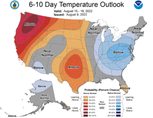
As we move into Tuesday and Wednesday, temps will rise into the upper 70s to mid 80s zone, but we’ll have to watch to see how high pressure to our north directs and influences a trough into the northeast U.S., which may give us a much-needed period of showers – here’s hoping!
Thanks so much for reading!
Have a great day, and please follow me on Twitter if you’re there…
AND REMEMBER…
“Hello babies. Welcome to Earth. It’s hot in the summer and cold in the winter. It’s round and wet and crowded. On the outside, babies, you’ve got a hundred years here. There’s only one rule that I know of, babies: Goddamn it, you’ve got to be kind.”
–Kurt Vonnegut