
Good morning folks, we’re not seeing as much fog out there this morning, and dew points are already into the upper 60s to mid 70s, so it’s super humid out the door this Sunday.
We’ve got heat and humidity with afternoon isolated showers and thunderstorms today and tomorrow and probably Tuesday followed by our heat wave breaking by Wednesday with a better chance of rain then, with continued humidity into Thursday and gorgeous dry weather arriving Friday, but before we dive into all of the weather details below, let’s check a note from our new local weekend sponsor, Yankee Mattress Factory based in Agawam, MA.
——————–
A NOTE ABOUT OUR WEEKEND SPONSOR
DHTWN is sponsored by members, patrons, and Yankee Mattress Factory. Yankee Mattress is employee-owned, and mattresses are handmade locally in Agawam, MA. Several years ago I purchased a Yankee mattress and bed and was very pleased with their quality and the buying experience, which was friendly and low pressure. Go into any Yankee Mattress store before Tax Free weekend (Aug 13-14) to lock in tax-free pricing and get your mattress delivered quicker. Visit the Yankee Mattress store closest to you in Agawam, Springfield, Northampton, or Greenfield, or click for more info: https://yankeemattressfactory.com/
——————————————-
***DHTWN DAILY WEATHER REPORT***
——————————————-
Good morning everybody, it’s Soupy Sales time this morning, and this writer has unwittingly contributed to this oppressive humidity by crying constantly whilst shaking my sweaty fists at the sky and threatening to kick that Bermuda High’s butt if it doesn’t vamoose to the east soon.
But, the one constant in life is change, and by late week we’ll finally get the exchange in air mass to a drier and cooler one from Canada.
Until then, soup’s on.
For today, expect mostly sunny skies as highs reach the mid 80s to mid 90s from north to south and highest elevation to the valley, especially its southern portion.
Heat Advisories continue through 8pm, as with dewpoints in the upper 60s to mid 70s, heat indices will reach the mid 90s to low 100s.
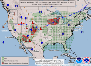
Winds will generally be light, and cumulus clouds will build in the afternoon with isolated showers and thunderstorms expected. It looks like they’ll move a bit quicker than the past two days, mainly southwest to northeast, or more west-southwest to east-northeast, so if you have outdoor plans you know where to direct your eyes in search of thundery sounds, darker cloud bellies or increasingly towering cumulus clouds.
Any activity dies down (thanks, Judith) this evening, and lows again will drop into the upper 60s to low 70s with patchy fog possible in northern CT mostly.
For Monday, another rinse-and-repeat day with highs in the upper 80s to mid 90s with hot and humid conditions, mostly sunny skies, and isolated showers or storms in the afternoon, dying down at night. Lows again will settle to either side of 70º.
Tuesday is hopefully when our heat will break, though southern Pioneer Valley areas may still crest 90º. For most of us north of the Pike, though, I think we only reach the low to mid 80s as clouds from the slowly-incoming cold front press south into our region, tamping down temps.
It’ll still be very humid, and we’ll still have afternoon scattered showers and thunderstorms. Lows should rest in the mid to upper 60s.
Wednesday looks like our best chance for more numerous showers and rain activity as the front gets closer, and the mid level flow to its south pushes a few waves through our region. Highs will be in the 80s, still very humid, lows in the upper 60s.
Thursday is hopefully the last day of these muggy conditions. Highs should only reach to either side of 80º with high humidity, some scattered showers and storms, and then by Friday our front clears the region to the south with much drier air coming into the region into the weekend!
Friday and Saturday should be dry, sunny, comfortably low humidity, and highs in the 75-80º range, with lows in the 50s.
#HellYes
Have a great day and stay hydrated, we’re getting there!